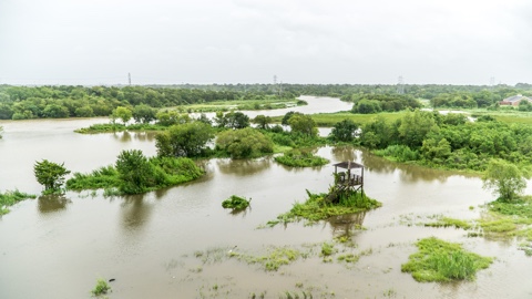
In 2016, NASA launched a set of eight satellites called the Cyclone Global Navigation Satellite System (CYGNSS) mission to gather more data on the winds in tropical cyclones as part of an effort to increase hurricane knowledge and aid in forecasting. As the first year of data is being evaluated, analysts have realized that the data also has the capability to see through clouds, rain, and vegetation to assess flooded landscapes.
The microwave signal the CYGNSS satellites use to detect wind speed based on the choppiness of the ocean originates from the Global Positioning Satellite (GPS) system – which is also responsive to reflections from standing water and the amount of moisture in the soil.
“Before about 2015, people had inklings that you could use GPS reflection data over land to look at various things, but there hadn’t been many observations to prove it,” said Clara Chew, a researcher at the University Corporation for Atmospheric Research in Boulder, Colorado. “With the launch of CYGNSS we’ve finally been able to really prove that yes, these signals are very sensitive to the amount of water either in the soil or on the surface.”
Using the CYGNSS data, Chew has been able to developed flood inundation maps of the Texas coastline after Hurricane Harvey and of Cuba after Hurricane Irma, as well as flood maps of the Amazon River in Brazil, which overflows its banks seasonally.
“When I saw the first land images of inland water bodies, I was amazed at their quality,” said Chris Ruf, CYGNSS’s principal investigator at the University of Michigan in Ann Arbor. “We had known beforehand that there would be some instances of coherent scattering possible. That’s the phenomenon that creates such high-resolution images. It rarely happens over the ocean and we hadn’t really considered how often it might happen over land. It turns out that it happens quite frequently, and almost always when observing small inland water bodies. This promises to open up entirely new areas of scientific investigation.”
