Researchers at the University of Leeds in the UK are using artificial intelligence to create a new satellite-based method of detecting warning signs of when a volcano is likely to erupt.
They utilized satellites that carry instruments equipped to collect imagery using interferometric synthetic aperture radar (InSAR). InSAR is a technique that can provide measurements of surface displacement from space to the millimeter. These measurements are used in the study of natural hazards – such as for earthquake analysis and landslide monitoring, and for monitoring human activities, such as oil and gas extraction.
Every time one of the satellites passes over a given volcano it can capture an InSAR image of the volcano from which ground movement away from or toward the satellite can be calculated. Such ground movements occur due to the movement of magma within the volcano.
It is difficult to continuously monitor the huge amount of images and data produced by the satellites, and – as some volcanoes exhibit long-lasting deformation that poses no immediate threat – new images must be compared with older ones to determine whether a deformation at a volcano signals an imminent eruption.
To solve these issues, the researchers developed an algorithm that can rapidly analyze InSAR data, compare current deformation to past activity, and automatically create an alert when a volcano’s unrest may be cause for concern.
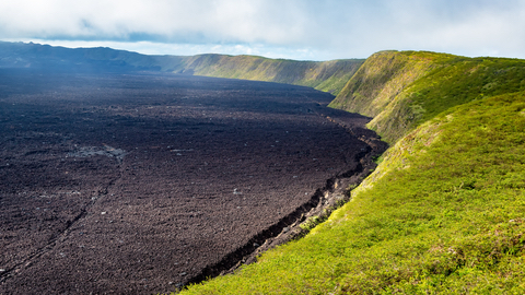
The team applied the algorithm to real data from the period leading up to the 2018 eruption of Sierra Negra – a volcano in the Galápagos Islands. The algorithm worked, flagging an increase in the ground’s inflation that began about a year before the eruption. Had the method been available at the time, the team considers it would have accurately alerted observers that Sierra Negra was likely to erupt.
